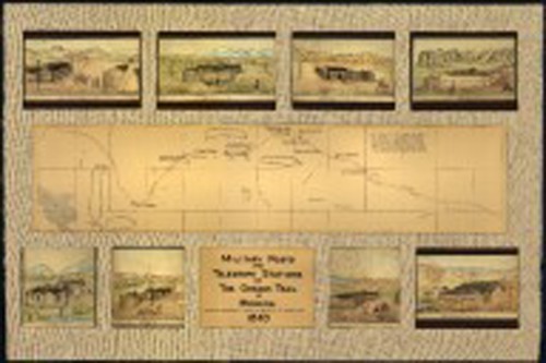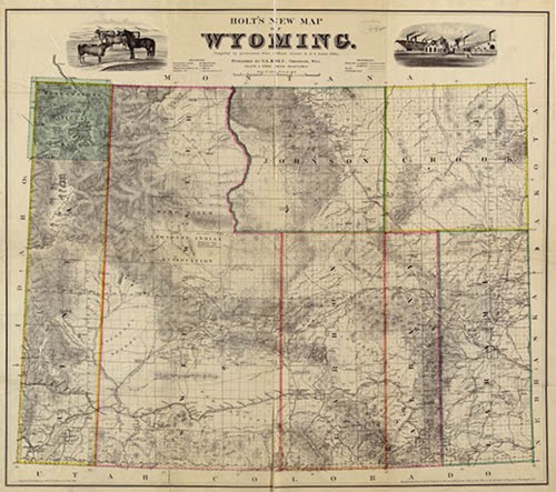
In 1862, Ben Holladay moved the route for his Overland Stage Line from the more northerly Oregon Trail route in the belief it would be safer from Native American attacks, as well as closer to Denver, by then booming from the Pikes Peak gold rush. Holladay named the route for his company and maintained stations along the line, which passed from Colorado into what’s now Albany County before heading west across Wyoming Territory. The present U.S. 287 highway follows the old stage route north from Colorado.
Holladay’s stations served travelers and agents at Virginia Dale, Colorado Territory, and in Wyoming Territory at Willow Springs, Big Laramie, Little Laramie, Cooper Creek and Rock Creek. Holladay outfitted his stations with hunters, blacksmiths and various other accommodations.
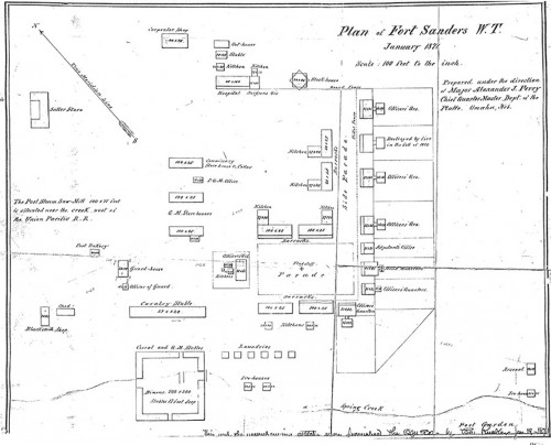
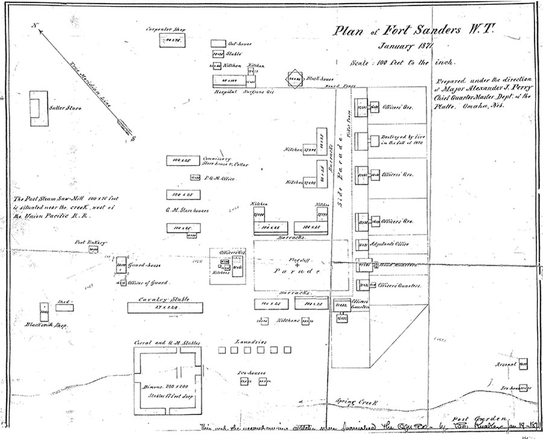
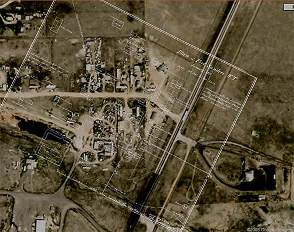
Native American attacks on travelers and stations increased in 1865. The U.S. Army decided to establish a post on the Big Laramie River as near to the Overland Stage route as possible. General John Pope charged Captain Mizner of the 18th U.S. Infantry with finding the best location for this fort. Fort Collins and Fort Halleck were being decommissioned at the time and their structures and stores were used in the creation of the new fort. In 1866, Mizner built the first permanent structure in the area. This was a wooden fort initially named Fort Buford in honor of General John Buford, a hero at Gettysburg and friend of General Pope. Since there was already a Fort Buford in Montana, confusion caused the name to be changed within months to Fort Sanders in honor of Brig. Gen. W.P. Sanders.
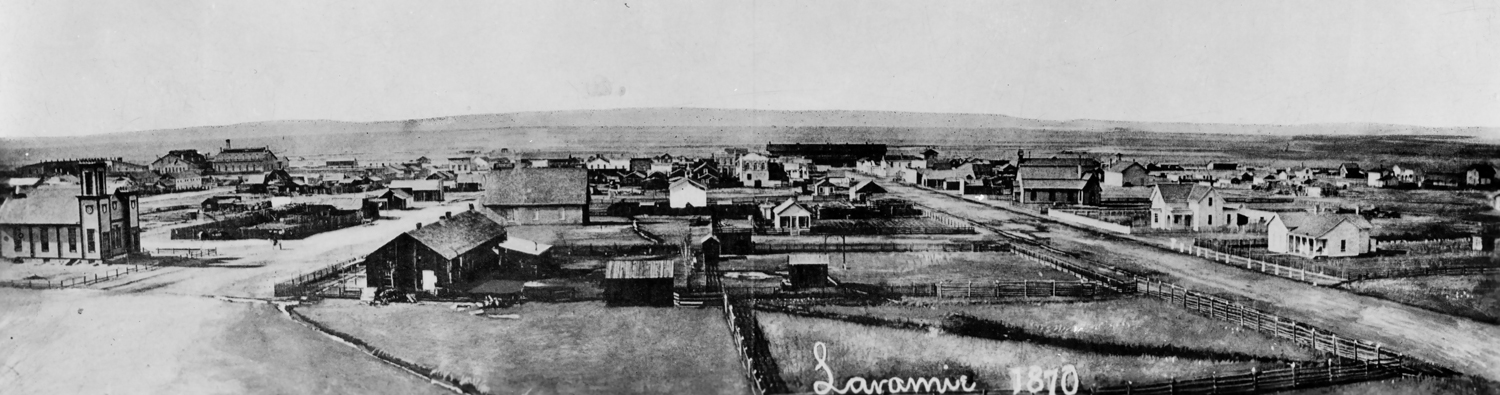
At one time 600 soldiers were housed at Fort Sanders, but numbers dropped due to fear of attacks. The military reservation covered 81 square acres of southeastern Wyoming in its heyday. The fort grounds were 223 feet (68 m) by 400 feet (122 m), including a parade ground. The post was originally built for four companies, but was later expanded to accommodate six. Nearly all of the buildings were constructed of wood except for the stone guardhouse, which was built in 1869 and remains the only structure standing today. Very little remains of the settlement which was decommissioned in 1882. The post Commander’s quarters were moved to LaBonte Park in Laramie and have been used as a community center and pre-school for decades.
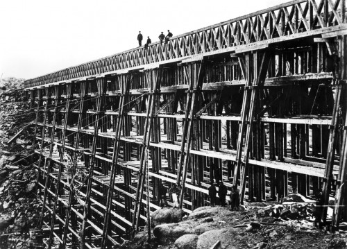
The garrison at Fort Sanders frequently protected railroad crews from attack all along the rail line from the Laramie Range and across the plains. Initially, Fort Sanders was the county seat for the original Laramie County (as created by the Dakota Territory), which was almost all of what later became the Wyoming Territory. On Jan. 3, 1868, Dakota lawmakers moved the Laramie County seat to Cheyenne and created a new Carter County out of the western half.
Learn more about the history of Fort Sanders and the building of the Transcontinental Railroad.